20th century local government administrators were a bit like their predecessors in colonial Africa and India – they drew maps and divided communities without any regard for the feelings or interests of the inhabitants.
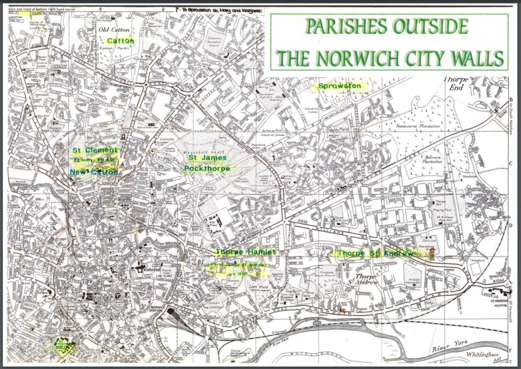
Where we live two vast districts were created. They were still called wards as in Norwich’s old medieval system. They were named after local celebrities from the 19th century – Sewell and Crome. Anna Sewell was the author of Black Beauty – her uncle lived at the White House way up on Spixworth Road. John Crome was a great landscape painter – one of his famous pictures is the beautiful Mousehold Heath. Wonderful, worthy people. The problem is you will rarely meet anyone who would say – Hey, I live in Sewell or Crome – people do not imagine them as their communities.
Reclaming a name
When the partition was made, a line was drawn down Silver Road and Mousehold Avenue to form the boundary between Crome and Sewell. This means that one part of our project, Sandy Park is in Sewell; whilst the other part, Kett’s Cave and the hoped for community garden, is in Crome. It is a pain and shows how what looks fine for administrators on a map does not serve the interests of the residents – we are forced in live in a bureaucratic blob which nobody feels belongs to them.
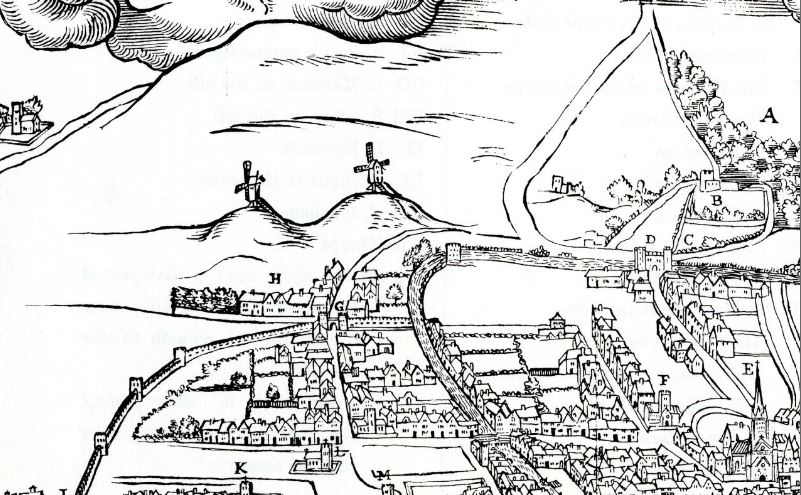
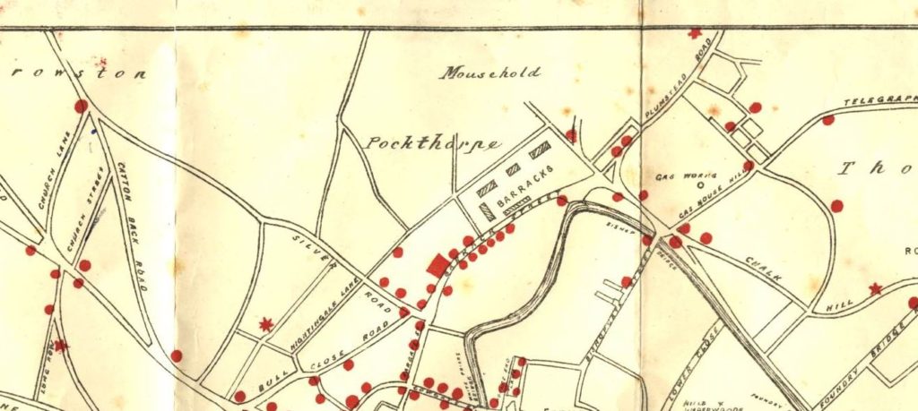
This is why we have taken a different name for our group. We have gone back to our roots to forge a new, stronger identity which all of us from both sides of the border will be able to relate to and call home. Pockthorpe was one of the medieval parishes of Norwich – it ran from the city walls at the bottom of Silver Road all along the north bank of the river as far as the bend by Cow Tower and up to the heights of Sandy Park. We were and are Pockthorpe. In the first post-medieval census of 1693, the parish had a population of 732. The city gate at Silver Road was called the Pockthorpe Gate. Steward and Patteson’s brewery across from the city gate was known as the Pockthorpe Brewery. The brewery was the big employer and owned land up as far up as Violet Road and Gertrude Road. You can still see part of Pockthorpe Gate and the only surviving part of Pockthorpe Brewery (the offices, presently occupied by QD) as you come down to Barrack Street. The Council and developers have done their best to destroy a feeling of a local community but as with the remains of the buildings the idea of Pockthorpe has made it through.
By celebrating our past, we can build a better future.
Welcome to Pockthorpe, where all are welcome and all can feel at home.